Upper
Deschutes Watershed Council
Water
Quality Monitoring Program Technical Report
Photo Monitoring for the
Vandevert Ranch Bank Stabilization Project OWEB #19-02-001
Lower
Little Deschutes River Watershed, Little Deschutes Subbasin,
Oregon
Prepared by: Lesley
Jones
Water
Quality Specialist
Upper
Deschutes Watershed Council
Bend,
Oregon
Prepared for:
Deschutes Soil and Water
Conservation District
Redmond, Oregon
Vandevert Ranch
Bend, Oregon
Upper Deschutes Watershed
Council
Bend, Oregon:
November 2006
Acknowledgments
The Upper Deschutes Watershed Council (UDWC)
would like to acknowledge the ODEQ 319 Grant Program and the
Oregon Watershed Enhancement Board for providing funding in
support of the UDWC Water Quality Monitoring Program. This
program provides effectiveness monitoring for restoration
projects across the upper Deschutes and Little Deschutes
Subbasins. The Photo Monitoring for the Vandevert Ranch
Bank Stabilization Project was made possible by OWEB.
Abbreviations and Acronyms
Organizations
Deschutes Co.
SWCD Deschutes Soil and Water Conservation
District
UDWC
Upper Deschutes Watershed Council
Units
Lat Latitude
Long Longitude
Table of Contents
1.0
Purpose
2.0
Monitoring Design
3.0
Results
5.0
REFERENCES
List of Tables
Table 1 Monitoring tasks
Table 2 Photo point locations
1.0
Purpose
The purpose of the monitoring is to evaluate
the success of the proposed tree placement bank stabilization
efforts at approximately 13 sites at the Vandevert Ranch. The
expected output is the qualitative interpretation of vegetation
success via photo point technique. The expected outcome is to
provide Deschutes Soil and Water Conservation District and Vandevert
Ranch the information needed to track a Bank Stabilization Project
located 3 miles upstream Little Deschutes River confluence with the
Deschutes River.
2.0
Monitoring
Design
Monitoring was designed to capture pre and post
project information. Pre-implementation project monitoring was
conducted September 23, 2002. Implementation and
post-implementation project monitoring was conducted October 2002
and ended October 2006. Monitoring tasks, schedule, and status are
reported in Table 1. The photo points and their
corresponding latitude, longitude, and bearing are detailed
in Table 2. Monitoring is conducted according to standards
detailed in the UDWC WQ Monitoring Program Standard Operating
Procedures; Field (UDWC 2006). Photo points were collected under
the USDA Photo Point Monitoring Handbook protocols (USDA
2002).
Table 1
Monitoring tasks
|
Date |
Monitoring Tasks |
Status |
|
Prior to project
implementation (mid-September 2002) |
Set up permanent photo
points.
Take first photos of each
site. |
Completed |
|
During implementation
(periodically) |
Photos from photo points |
Completed |
|
Following project completion
(October) |
Photos from photo points |
Completed |
Table 2 Photo
point locations
|
Site |
Camera lat |
Camera long |
Camera bearing |
|
Control
point |
|
|
320° |
|
Site 1 |
43.99444 |
121.5775 |
306° |
|
Site 2 |
43.9975 |
21.60917 |
180° |
|
Site 3 |
43.01861 |
121.61139 |
312° |
|
Site 4 |
43.99333 |
121.62583 |
66° |
|
Site 5 |
44.02472 |
121.66139 |
142° |
|
Site 6 |
44.02472 |
121.66139 |
4° |
|
Site 7 |
44.03583 |
121.66167 |
328° |
|
Site 8 |
44.08472 |
121.65583 |
326° |
|
Site 8A |
44.08472 |
121.65583 |
88° |
|
Site 10
|
44.09028 |
121.62472 |
10° |
|
Site 11A |
43.86917 |
121.65361 |
120° |
|
Site 11B |
43.86917 |
121.65361 |
314° |
|
Site 11C |
43.86917 |
121.65361 |
42° |
|
Site 12 |
43.88639 |
121.66417 |
2° |
|
Site 13 |
43.87861 |
121.64194 |
280° |
|
Site 14 |
43.83637 |
121.44647 |
346° |
|
Site 15 |
43.83686 |
121.44677 |
160° |
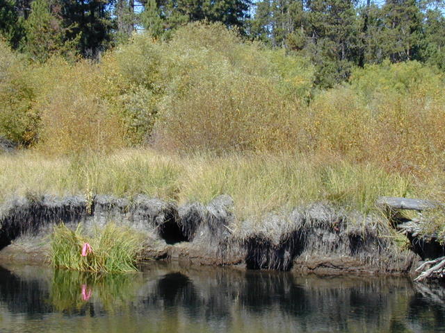
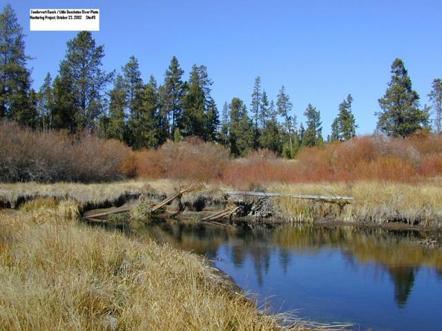
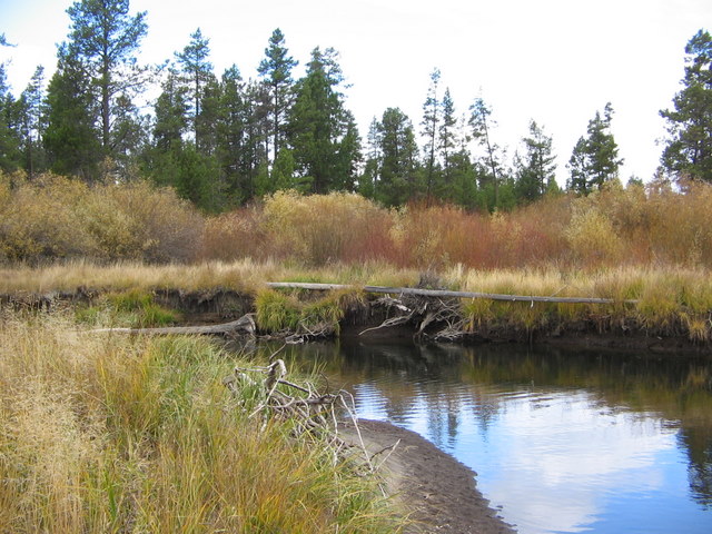
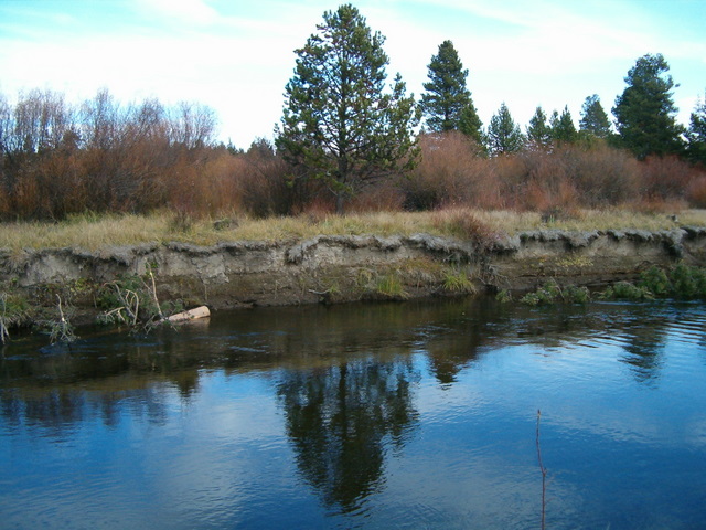
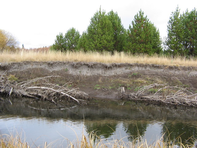
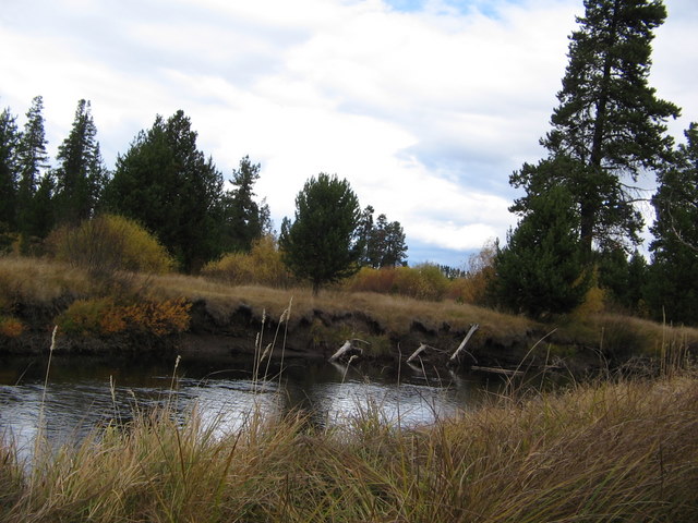
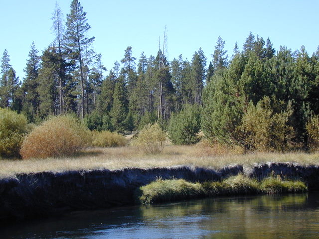
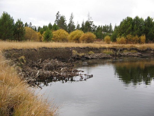
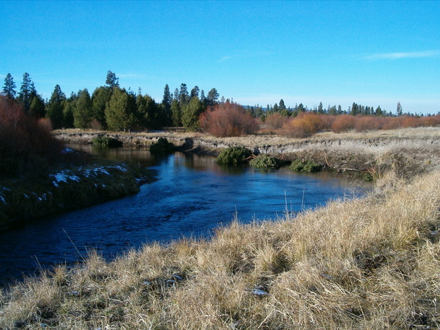
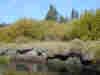
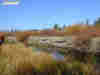
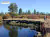
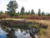
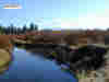
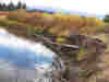
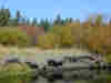
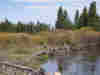
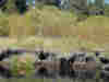
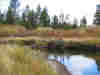
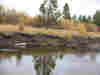
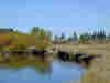
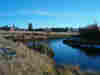
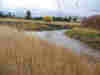
3.0
RESULTS
(The results section presents the photos taken
as described in Section 2 on monitoring. The sites are in
order from south to north, in the direction of the river's flow.
Note that there are no "Pre-implementation" photographs for some of
the sites.)
|
|
|
|
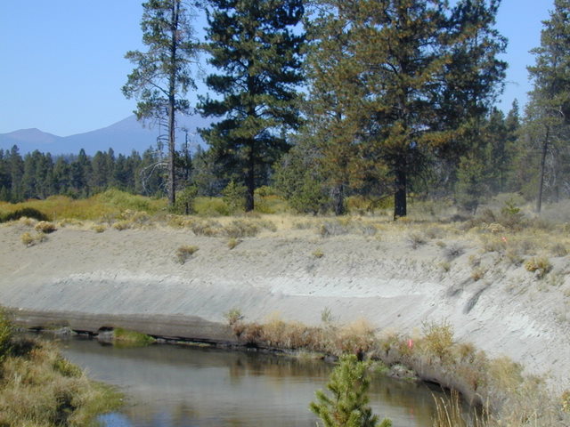
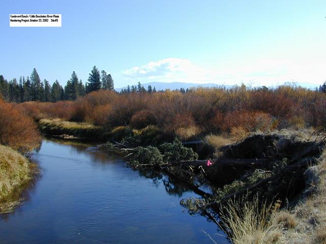
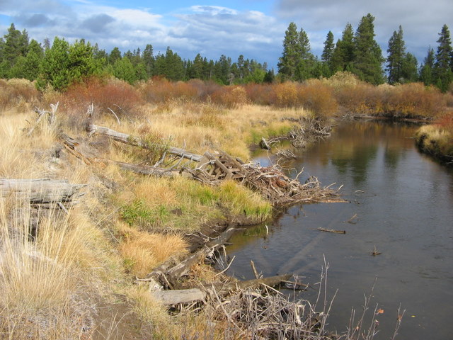
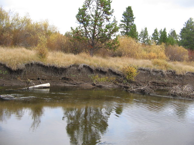
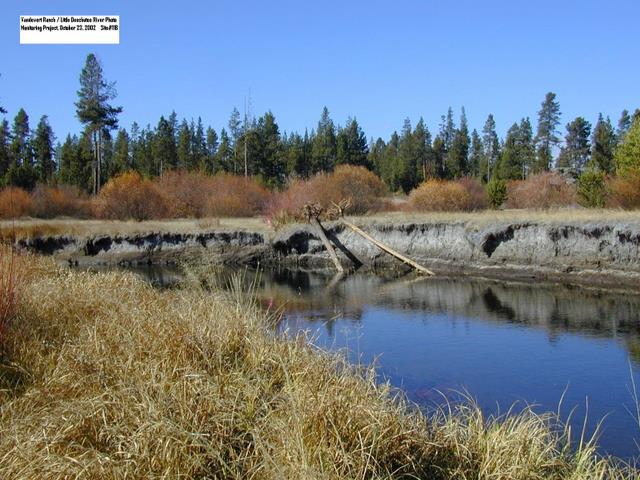
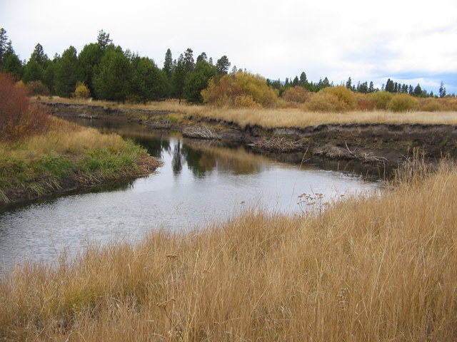
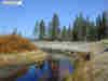
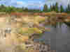
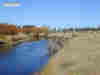
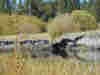
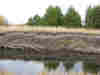
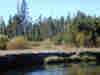
Site 1 Pre-implementation Sept 23, 2002
|
|
|
|
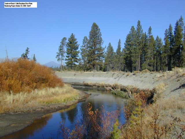
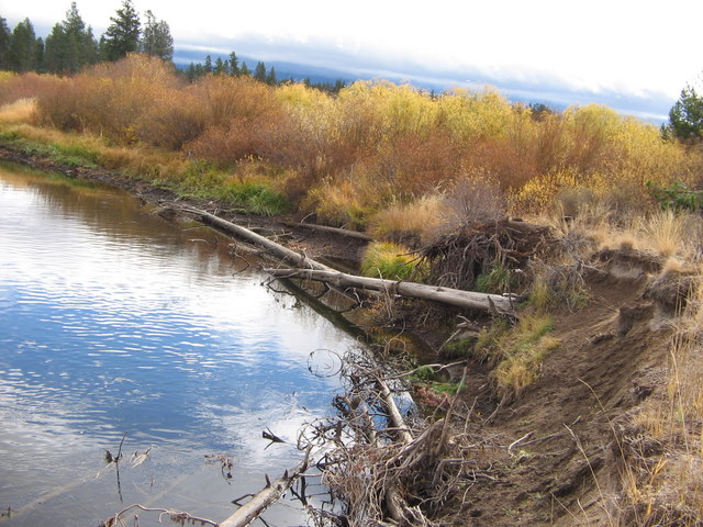
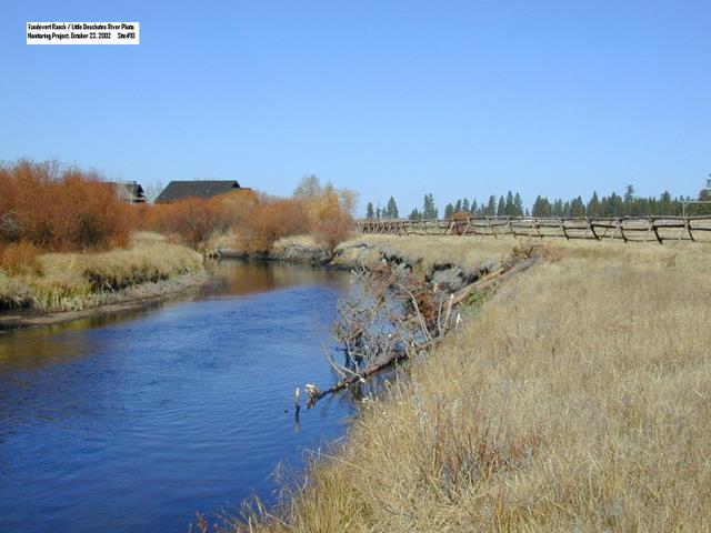
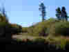
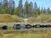
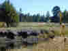
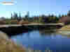
Site 1 Post-implementation October 23, 2002
|
|

|
|
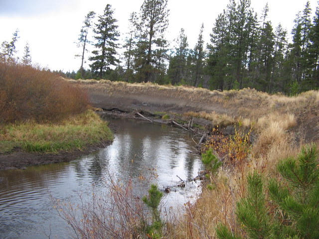
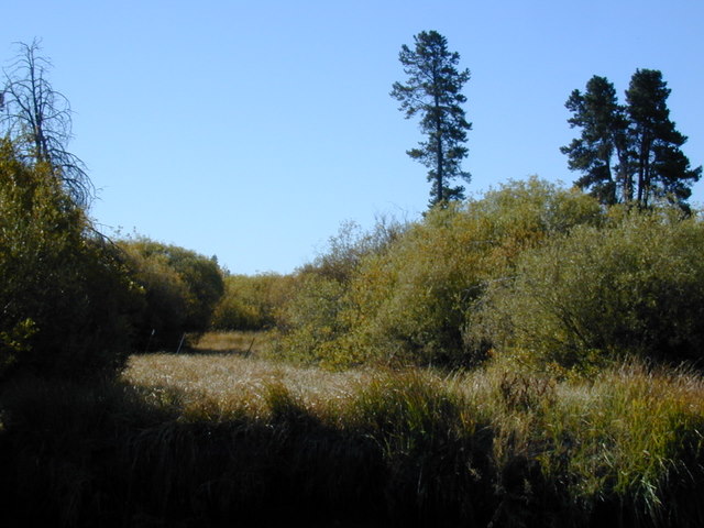
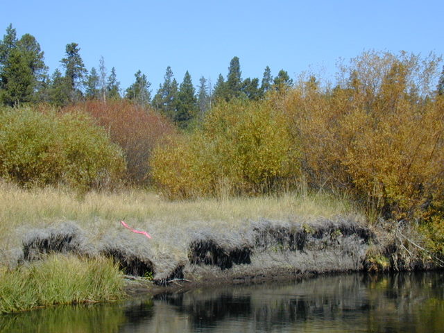
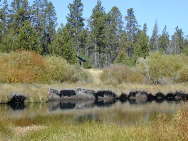
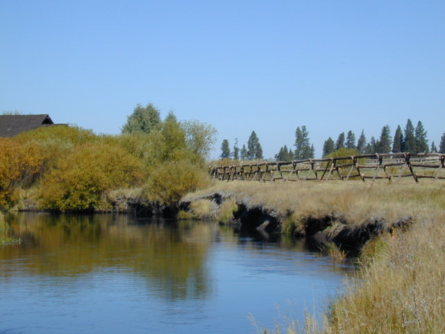
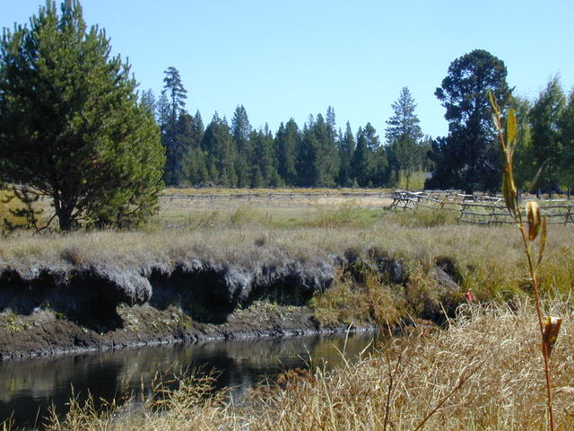
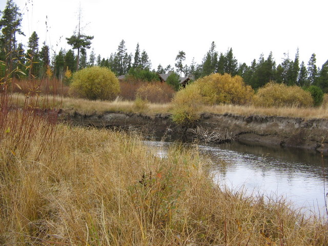
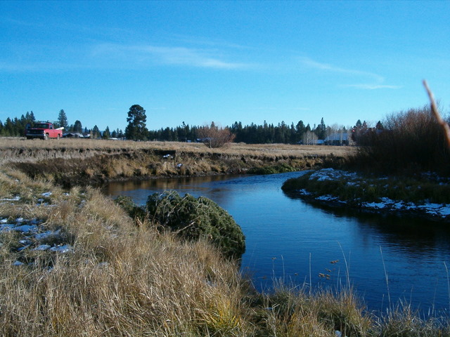
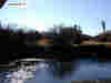
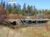
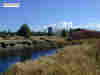
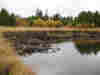
Site 1 October 19, 2006
|
|
|
|
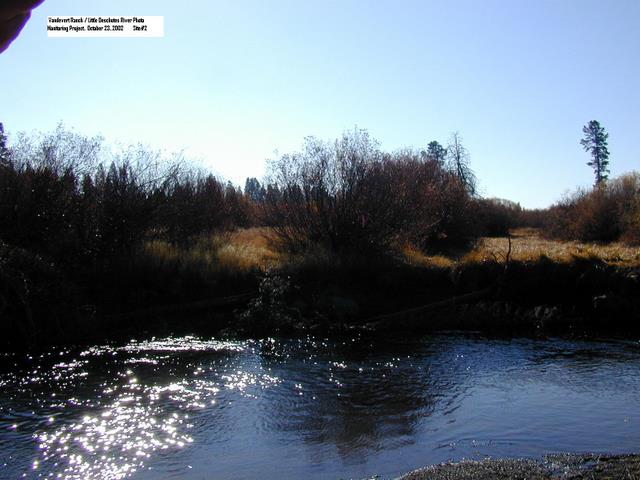
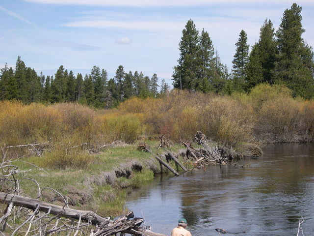
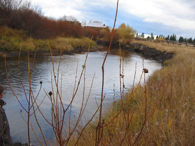
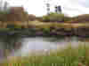
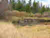
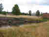
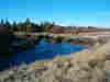
Site 2 Pre-implementation Sept 23, 2002
|
|
|
|
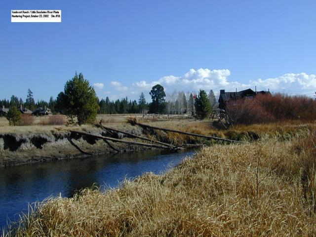
Site 2 Post-implementation October 23, 2002
|
|
|
|
|
|
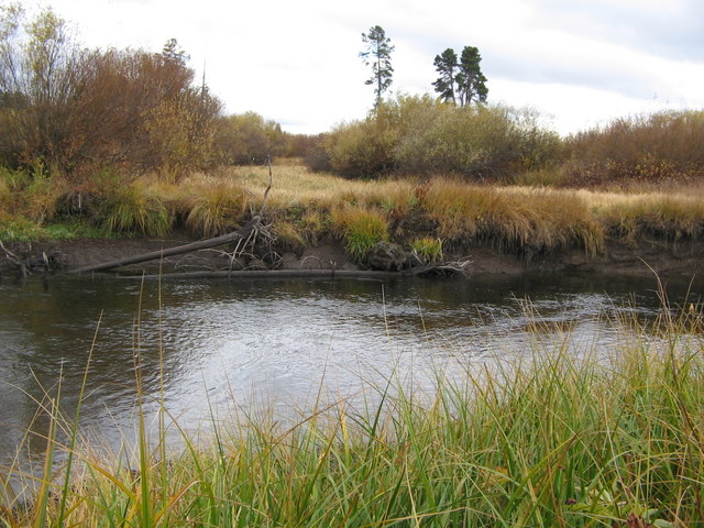
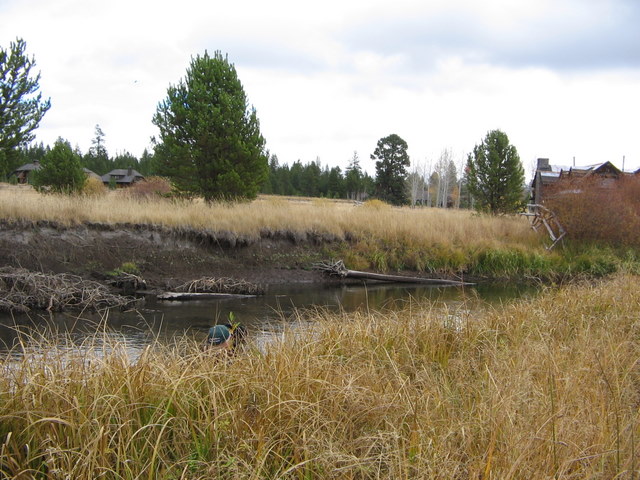
Site 2 October 19, 2006
|
|
|
|
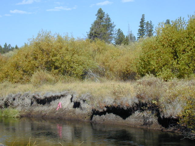
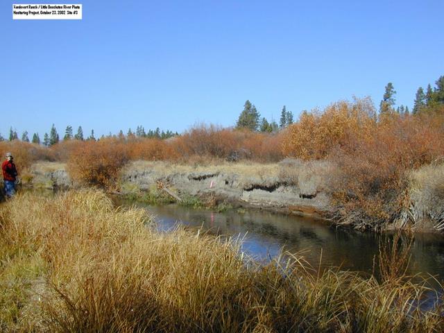
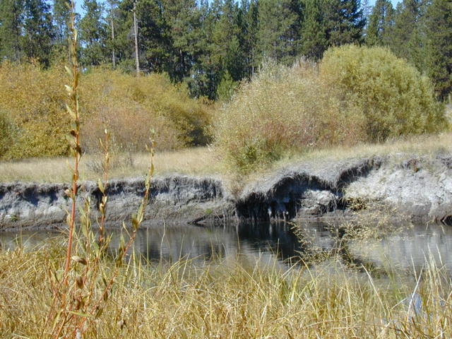
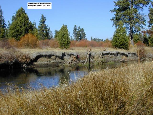
Site 3 Pre-implementation Sept 23, 2002
|
|
|
|
Site 3 Post-implementation October 23, 2002
|
|

|
|
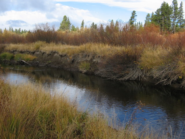
Site 3 October 19, 2006
|
|
|
|
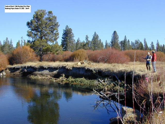
Site 4 Post-implementation October 23, 2002
|
|
|
|
|
|
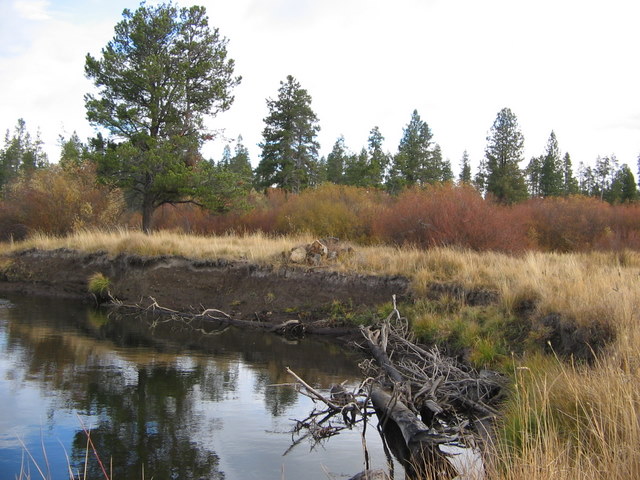
Site 4 October 19, 2006
|
|
|
|
Site 5 Post-implementation October 23, 2002
|
|
|
|
Site 5 October 19, 2006
|
|
|
|
Site 6 Pre-implementation Sept 23, 2002
|
|
|
|
Site 6 Post-implementation May 22, 2003
|
|
|
|
|
|
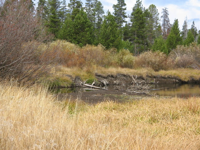
Site 6 October 19, 2006
|
|
|
|
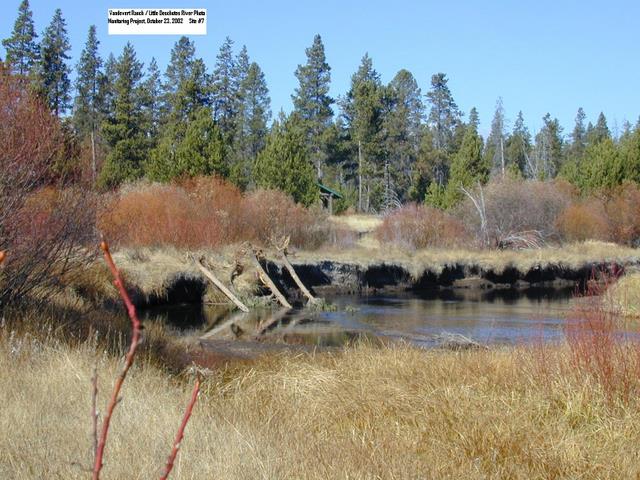
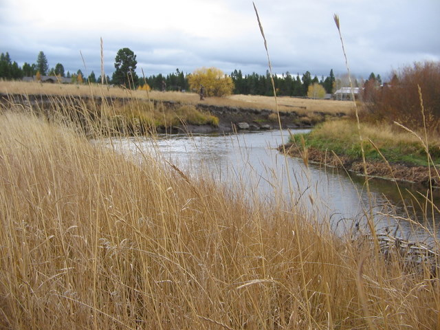
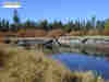
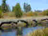
Site 7 Pre-implementation Sept 23, 2002
|
|
|
|
Site 7 Post-implementation October 23, 2002
|
|
|
|
Site 7 October 19, 2006
|
|
|
|
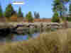
Site 8 Pre-implementation Sept 23, 2002
|
|
|
|

|
|
Site 8 Post-implementation October 23, 2002
|
|
|
|
Site 8 October 19, 2006
|
|

|
|
Site 8A Post-implementation October 25, 2004
|
|
|
|
Site 8A October 19, 2006
|
|
|
|
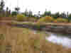
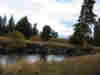
Site 10 Pre-implementation Sept 23, 2002
|
|
|
|
|
|
Site 10 Post-implementation October 23, 2002
|
|

|
|
Site 10 October 19, 2006
|
|
|
|
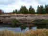
Site 11A Pre-implementation Sept 23, 2002
|
|
|
|
Site 11A Post-implementation October 23, 2002
|
|
|
|
Site 11A October 19, 2006
|
|
|
|
|
|
Site 11B Pre-implementation Sept 23, 2002
|
|
|
|
Site 11B Post-implementation October 23, 2002
|
|
|
|
Site 11B October 19, 2006
|
|
|
|
Site 11C Post-implementation October 25, 2004
|
|
|
|
Site 11C October 19, 2006
|
|
|
|
|
|
Site 12 Pre-implementation Sept 23, 2002
|
|
|
|
Site 12 Post-implementation October 23, 2002
|
|
|
|
Site 12 October 19, 2006
|
|
|
|
Site 13 Pre-implementation Sept 23, 2002
|
|
|
|
Site 13 Post-implementation October 23, 2002
|
|
|
|
|
|
Site 13 October 19, 2006
|
|
|
|
Site 14 Post-implementation November 4, 2004
|
|

|
|
Site 14 October 19, 2006
|
|
|
|
Site 15 Post-implementation November 4, 2004
|
|
|
|
Site 15 October 19, 2006
|
|
|
5.0 REFERENCES
UDWC (2006).
Water Quality Monitoring Program Standard Operating Procedures;
Field. Prepared by Jones, L.M., Upper Deschutes
Watershed Council, Oregon.
USDA (2002).
USDA Photo Point Monitoring Handbook Part A-Field Procedures.
Prepared by Hall, F.C., United States Department of
Agriculture, Pacific Northwest Research Station, General Technical
Report #PNW-GRR-526.
Return to
Vandevert Ranch Environment