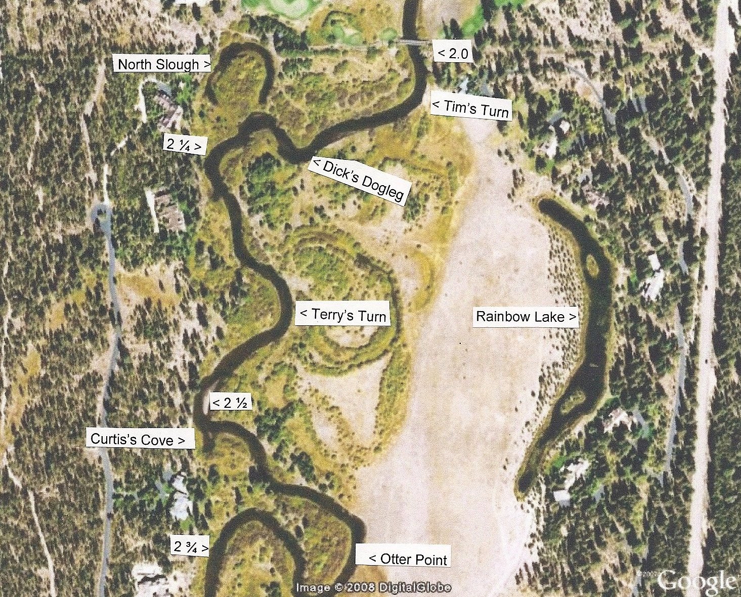
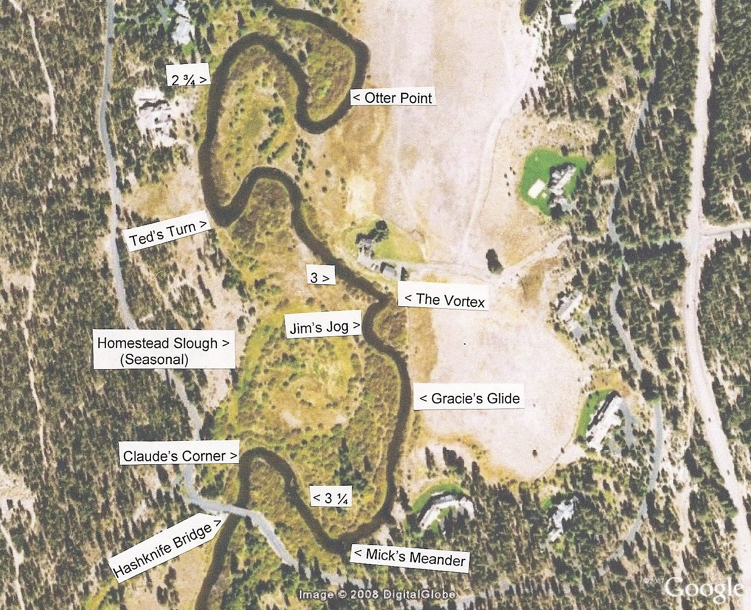
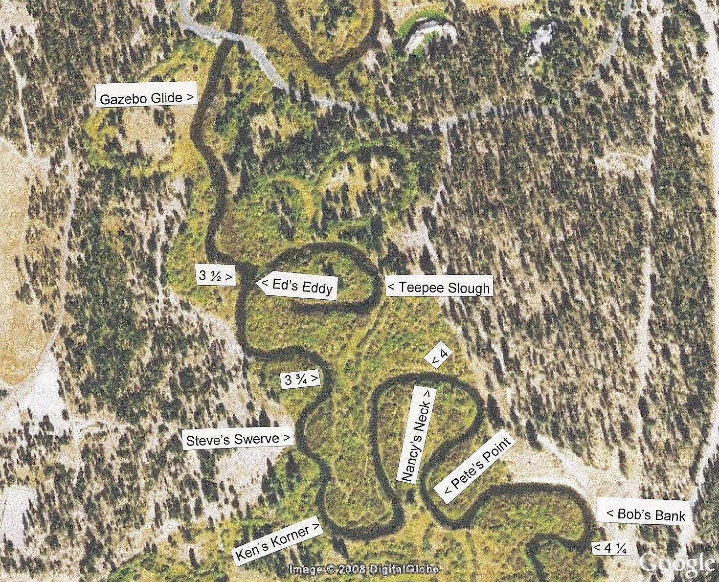
Little Deschutes River on Vandevert Ranch
River Miles and Named Points
The Little Deschutes flows two miles from south to
north through the ranch. Points on the three maps below are
named after well-known features, after past presidents of the
Vandevert Ranch Association board of directors, for the ranch foreman,
and for two others who grew up on the ranch and have contributed significantly to the ranch
Stewardship Plan - Claude Vandevert and Grace Vandevert McNellis.
Numbers on the map indicate the miles from the mouth
of the river, in this case the river's junction with the Deschutes.
River miles are indicated on US Geographical Survey maps by X's or
crosses at the mile marks and with a number next to the X or cross
every five miles. The river has cut off two oxbows (creating
the North Slough and Teepee Slough) since the latest USGS map was
drawn. The river miles on the maps below, labeled every
quarter mile, conform to the USGS map for the sake of
consistency and include the abandoned oxbows.
Downstream (Northernmost) Section of River (shown below)
Midstream Section of River (shown below)
Upstream (Southernmost) Section of River (shown below)
Return to Stewardship Plan Table of Contents