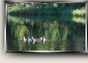
Riparian Environment – Description and History
 The Little Deschutes River meanders for two
miles through Vandevert Ranch. See the
Wetlands Map
and the description of
the Course of the Little Deschutes
in the appendices. Sometimes as a lake and sometimes as a river, the
waters of the Little Deschutes have been flowing through this same
valley for about a million years. A profusion of old
river channels is visible on aerial photos and on Google Earth. As
recent examples, two oxbows shown in a
1979 aerial photo have since been cut off by the river.
The Little Deschutes River meanders for two
miles through Vandevert Ranch. See the
Wetlands Map
and the description of
the Course of the Little Deschutes
in the appendices. Sometimes as a lake and sometimes as a river, the
waters of the Little Deschutes have been flowing through this same
valley for about a million years. A profusion of old
river channels is visible on aerial photos and on Google Earth. As
recent examples, two oxbows shown in a
1979 aerial photo have since been cut off by the river.
Claude Vandevert, who was born in 1923 and grew
up on the ranch, reports, “The closest thing Dad did to changing the
river channel was in the early 1930's. He put a dam across the
river at the north end of the ranch just before the river turns east
toward the schoolhouse. His intent was to flood the meadows
following the high water season and improve the hay crop. He
managed to raise the water level at the house about 18 inches and it
looked like it was going to work, but the pressure was too great and
the water washed out around the cribbing and he lost all his work."
(There are no traces of this dam today.)
Claude further reports, “There was in a deep
bend in the river about half way between the house and the South end
of the ranch. The river turned East there then came back West
leaving a neck of land between the two about 100 feet wide when I
was small. I had been away from that part of the ranch for several
years after I grew up, but when I saw what had happened in the
intervening years, I was shocked. There was only about six or eight
feet across that neck. I suggested Dad get a lot of rip-rap placed
against the two banks to stop the erosion. But he felt that it would
be too costly and did nothing. The last time I saw it, the river
had broken through and formed an island with 3 to 5 acres in it, and
of course the start of another slough.” (The
1979 aerial photo
shows the river still flowing in what is now the extensive slough
south of the teepee.)
The Vandevert family’s bridges and the current
bridge are not judged to have had a substantial impact on the
environment, although Claude's sister Grace notes, "What I'm always
amazed at is how the river has cut the bank back so much just across
the river from the "guest house" where our garden use to be.
There would be no garden there now. Couldn't even re-build the
"Big Bridge" as it was before - - it would have to be moved." The developer compensated for the wetlands that the
current bridge displaced by building the pond (outside the riparian
area).
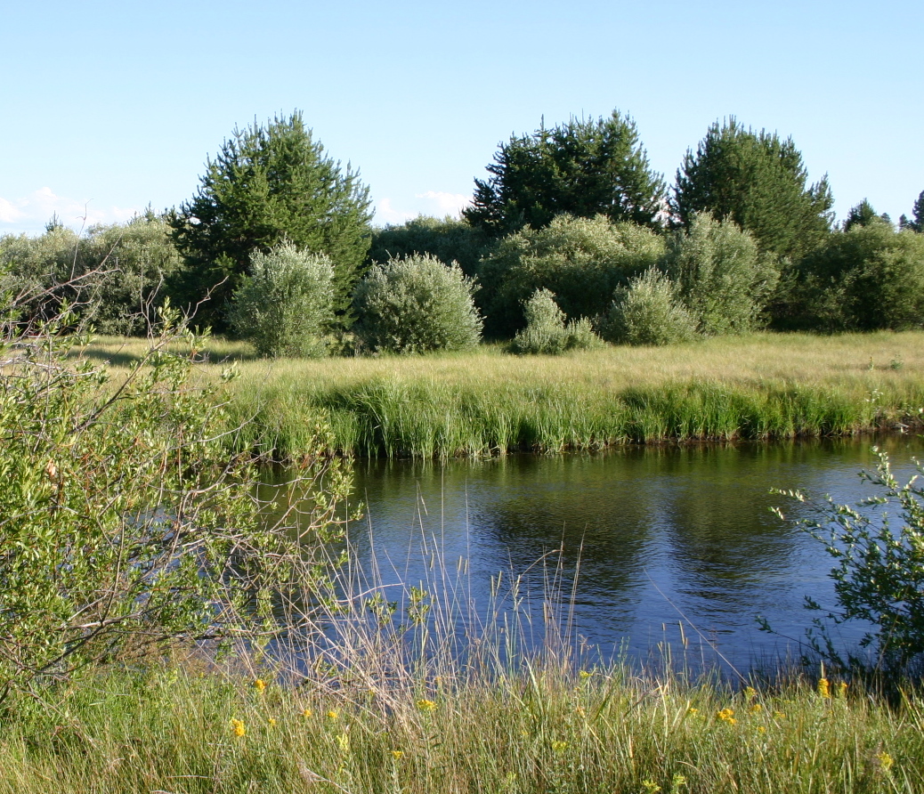
The wetlands and floodplain constitute the
wildest and most “natural” part of the ranch. They are well on the
road to recovery from eighty years of cattle grazing (from 1892 to
the 1970’s) which collapsed some banks into the river and limited the
growth of willows.
Under the supervision of
the ranch foreman, two riparian planting projects were completed in
2004. A Continuous Conservation Reserve Program (CCRP - managed by
USDA) planted 19,100 seedlings in 80 acres of the 110 acre riparian
zone. An additional 38 acres, including land outside the riparian
zone east of the barn and adjacent to Lot 15, were planted under a
contract with the Deschutes River Conservancy (DRC) in exchange for
carbon sequestration credits. A total of 33,215 plants (including
cottonwoods, red osier dogwood, and 10,000 ponderosa pines) were
acquired and installed at no cost to the Ranch. Unfortunately
almost all of the plants, except the ponderosas, were killed by
gophers or by soil conditions inhospitable to the plants selected.
The ponderosas that are doing the best are a little above the flood
plain. The ones in the floodplain are more vulnerable to
varmints (e.g gophers) and to frost. After 2-3 years the
ponderosas in the frost pockets can withstand the frost.
Under the federal Clean Water Act, states must
set water quality standards, monitor rivers and lakes, and report to
the federal Environmental Protection Agency (EPA), on a “303(d)”
list, any water bodies that do not meet the standards. The Little
Deschutes is not listed for any chemical or biological pollutants
but is listed from 50 to 73 miles above the ranch for high water
temperature. Higher water temperatures cause the level of
dissolved oxygen in the water to be low and the river is listed for
low dissolved oxygen from its mouth up to well above the
ranch. Dissolved oxygen is essential for the survival of fish, all
other water animals, and zooplankton. Oxygen also improves the
odor, clarity, and taste of water. Nitrate levels are not currently
a problem but are a long term concern (see
Hydrology).
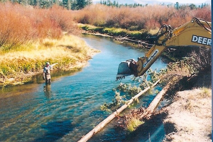 Under two grants
administered by the Oregon Water Enhancement Board, the ranch has
done extensive work to stabilize the river banks and improve fish habitat.
(See report in the appendices) The
work consisted of anchoring live pine trees, harvested from the
ranch, horizontally along the banks of the river at or below water
level (See photo at right taken when the water level was low.
The water is flowing toward the camera). The trees prevent erosion and help to direct water toward
the center of the river. Deeper, narrower, and faster currents
clear silt from between the small stones on the river floor,
creating a better environment for spawning and for the small aquatic
animals that are food for fish.
Under two grants
administered by the Oregon Water Enhancement Board, the ranch has
done extensive work to stabilize the river banks and improve fish habitat.
(See report in the appendices) The
work consisted of anchoring live pine trees, harvested from the
ranch, horizontally along the banks of the river at or below water
level (See photo at right taken when the water level was low.
The water is flowing toward the camera). The trees prevent erosion and help to direct water toward
the center of the river. Deeper, narrower, and faster currents
clear silt from between the small stones on the river floor,
creating a better environment for spawning and for the small aquatic
animals that are food for fish.